Showing posts with label high point. Show all posts

Friday, October 21, 2016

Highpoint #38: Borah Peak, ID (12,668')

What does one do with an unclimbable mountain? Give it a try anyway and see how high you can go.

I woke before dawn the next morning due to both nerves (upon my decision) and the commotion of day-hikers arriving. The air was frigid; I shivered all the way to the outhouse, where I tugged on my spandex climbing-pants and down jacket (though, as usual, I'd shed the latter within the hour). I packed away my tent, strapped my new trekking poles to my day-pack, locked the car, double-checked that it was locked, and--oh, there's no sense delaying it. Up the mountain I went.

Borah or bust...?
I honestly didn't expect to make it to the summit. Something--bad weather, elevation, exposure, exhaustion, Pamola's last revenge--was sure to intercept me along these next 3.4 horizontal miles (and 5200' in gain) and force me to turn back. And, honestly, I'd be lucky if that was the worst of it. The mountain would remain after a failed attempt; would I? (I'd like to think I have enough sense to keep myself alive, but I'll admit the matter's not entirely in my hands.)

But the route up Borah began, as all trails do, relatively gently, as a simple dirt path.

Thursday, October 6, 2016

High Point #37: Guadalupe Peak, TX (8751')

I headed out early the next morning, since all the campsites at my destination, Guadalupe Mountains National Park, were first-come-first-served (and it was a Friday, too). The roads through the eastern New Mexico plains were nearly empty. I made good time at a conservative 5 mph over the speed limit. The shoulders were littered with the night’s crop of dead jackrabbits, whom the vultures would no doubt devour before evening. I bypassed Roswell around midmorning (seeing nothing weird in the skies, but you never really know...) and stopped for lunch in touristy Carlsbad.

New Mexico has so much character, I thought as I drove through town, with all its adobe buildings and clay-tiled roofs and fiestas and roadrunners and red-or-green chili peppers. It's a land apart from the lawns and shade trees of suburbia, a place that's not afraid to flaunt its differentness. And, what's more, I fit in with the locals; we're all suntanned and at least vaguely Hispanic (unlike, say. Minnesota, where my dark features stuck out like a sore thumb). Call me enchanted.

As I emerged from the built-up part of Carlsbad, I spotted the Guadalupe Ridge on the horizon:

Note the drop at the end.
The long ridge rises up from the desert and follows a gentle curve southwest for nearly a hundred miles, looking for all the world like the spine of some long-dead earth giant.

Monday, October 3, 2016

High Point #36: Black Mesa, OK (4975')

I popped back over the state line to spend the night in Lamar, CO--the only town within a hundred miles large enough to host multiple motels--then woke with the sun and headed south down US-385 to the Oklahoma Panhandle. The low scrub of the plains did little to keep the sun from my eyes; the 18-wheelers I kept having to pass did much better, though with the side effect of checking my speed to the posted limit (sigh).

The Panhandle, by the way, has quite the interesting history. Originally part of the Republic of Texas, the strip was ceded to the federal government when Texas joined the U.S. as a slaveholding state, since that land was north of the 36°30' slave/free cutoff imposed by the Missouri Compromise. It spent the second half of the 19th century as an unorganized no-man's-land, serving as a hideout for outlaws and squatters. Towards the end of the century it campaigned to be recognized as its own Cimarron Territory, but was instead incorporated into the Oklahoma Territory in 1890.

I arrived around midmorning at Black Mesa State Park only to discover that the high point wasn't actually there:

Lies!
but in Black Mesa Nature Preserve a few miles up the highway.

Friday, September 30, 2016

Highpoint #35: Mt. Sunflower, KS (4041')

And when I say east, I mean straight-as-a-line exactly due east. That's how the roads are, out on the plains, and CO-94 was no exception. I spent the rest of the afternoon zipping down that two-laner, which eventually joined up with US-40, with the sun at my back (for once!). A few miles past Arapahoe I crossed the border into Kansas, and a few miles after that I turned onto a gravel road that took me north through twelve miles of cornfields to another gravel road, which in turn brought me the remaining mile to the high point. It was appropriately marked, I'd say:

Though, ironically, the area had the fewest sunflowers of any Plains high point (if you don't count the metal ones).
Like Panorama Point, Mt. Sunflower was also on active rangeland, but its approach was somewhat gentler on my car. I followed the dirt track up from the road and onto a slight rise in the middle of nothing.

Thursday, September 22, 2016

High Point #34: Panorama Point, NE (5427')

It was on that long drive south through the High Plains of Wyoming that I finally got the hang of passing across the yellow line. The trick to it is to drift a little over the line so you can see around whatever giant truck or RV is blocking your way. If there's oncoming traffic, you can zip right back into place, but if not (and in Wyoming, there's usually not), you can go for it.

From the Black Hills I followed US-18 through Lusk (whose gas station was abuzz with motorcycles leaving Sturgis), then continued south down US-85 through Lingle and Torrington. Along the way I passed miles and miles of empty rangeland, sunbaked buttes, blizzard gates, and tiny towns that stuck out like oases from the prairie. I noticed that one such town, Hawk Springs, listed its elevation on the town sign rather than its population... because the former was the higher number? At Cheyenne I returned at last to civilization. I got a motel room and some supper, scrubbed off the dust of the Black Hills, and slept straight through to the dawn.

-

The next morning I spent some time catching up on my online life (thankfully, there'd been no more attacks on my email account), then headed out around 11 am (still on Mountain time) towards the Nebraska high point. I-80 took me all the way to Pine Bluffs, a scenic little town along the WY-NE border. The Bluffs it's named for are a long row of pine-covered cliffs--a sort of Black Hills-lite--that drop from the Nebraska plains to the slightly-lower plains on the Wyoming side. I climbed the bluff south of town, followed its edge southward, and then veered east to cross the border. The gravel roads were lined with sunflowers--a theme of these Plains high points:

Wednesday, September 21, 2016

High Point #33: Black Elk Peak, SD (7244')

Having returned safely to my car, I drove back towards Amidon. Funny, I thought as I passed through the town, how people plant trees and green lawns wherever they go. Why not embrace the unique palette of the Great Plains rather than forcing it to conform to the stereotypical suburban vision? It scares me a bit how that single aesthetic holds such sway, even in a place as remote as this.

I filled my tank in Bowman, then headed south on US-85 for the Black Hills. The first two thirds were much like the previous day's drives: a long, gently rolling trip through a whole lot of nothing (except for distant buttes, which I ogled). I spaced out the whole way through. It was wonderful.

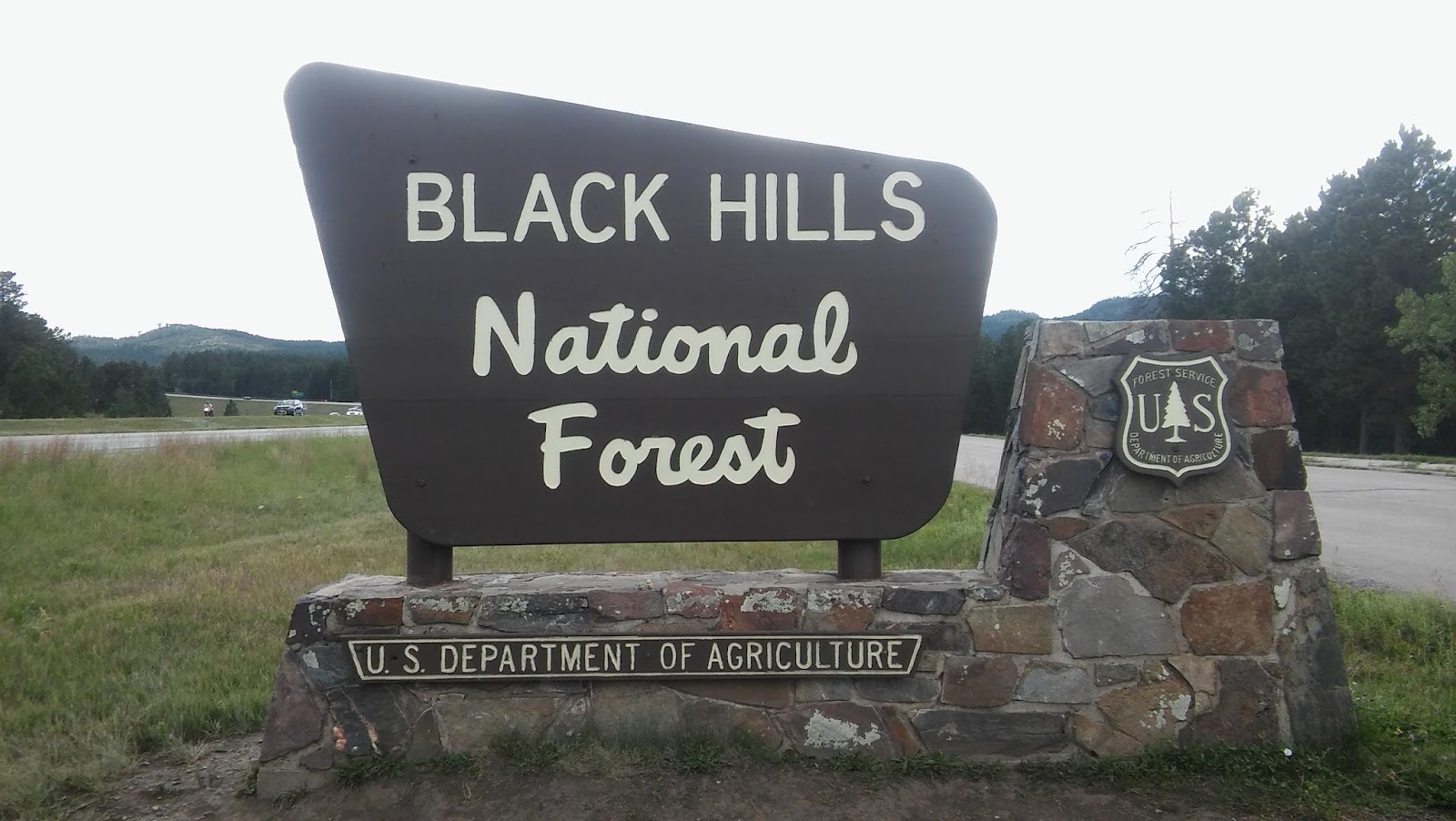
Returning to I-90 (by way of Belle Fourche) was a shock to my system. Welcome back to the billboards, the traffic, the ugly, boxy, light-flashing sprawl of humanity. To think I missed this just a day ago (well, more like I missed its conveniently-located gas stations, but I suppose you can't have one without the other). I circled southeast around the Black Hills, passing through Sturgis--at the time it was hosting its massive annual motorcycle rally, which explained all the bikers I’d been seeing everywhere--and exited at Rapid City, which was indeed citylike in size. The build-up stretched down US-16 all the way to the entrance of the Black Hills National Forest:


Monday, September 19, 2016

High Point #32: White Butte, ND (3506')

Did you know that the western third of South Dakota (and the corner of North Dakota I visited) is on Mountain time? Neither did I until I reached Faith, a tiny town on the South Dakota plains that was home to the first civilization (read: gas station) I'd seen in hours. "Next Services 53 Miles," my tail. The gas was expensive, but I filled that tank all the way up--what choice did I have?  Afterwards, I popped into the convenience store for a snack. As I ate I leafed through the local newspapers, which were full of local ranch news and columns like "Ramblings of a Conservative Cow Doctor." In the process, I realized just how little I knew about farming and ranching--I couldn't tell a hay baler from a milking machine if my life depended on it. Perhaps we all ought to put a little more thought into how the food we eat is grown and raised.

And yes, their stockyard was a PokeStop.
I headed north again from there, then turned west onto US-12 at Lemmon, ND.The fields all around were a sun-scorched orange, empty save for the stray herd of cattle (or possibly buffalo, though I couldn't spare my eyes from the road long enough to tell the difference). Tumbleweeds (for real!) cut across the road in front of me, as did several foot-high, squat, terrestrial birds--prairie chickens!

Well, more likely sharp-tailed grouse, but those don't sound half as funny.
Though the late-afternoon sun left me half-blind, I did my best not to run them over (to my kid brother's disappointment--Joey, you monster, those chickens have families).

Friday, September 16, 2016

Highpoint #31: Hawkeye Point, IA (1671')

I got a late start out from Duluth that morning and spent most of the day cutting a diagonal across Minnesota. Along the way I witnessed landscape change in action: from the rolling hills of the North Woods along the northern half of I-53 to a transition zone of agriculture and scattered groves and then at last to the Great Plains. The land had flattened out by the time I hit Minneapolis (where I crossed the Mississippi one final time, though it was so narrow that I mistook it for just another highway overpass). By Mankato the forests were done, and beyond that was pure prairie. The only trees were windbreaks around houses; the tallest shapes on the horizon were silver grain elevators.

Shortly afterwards, I spotted another storm sweeping east to meet me: huge and dark, just like yesterday's. The other cars seemed unconcerned, so I drove on, but every few seconds I found myself glancing up to the deep-gray clouds, tracking their progress. Weather is so much more intense out on the plains than any forest- or city-dweller can imagine. You see it coming for minutes, even hours, before it hits. Slowly but unstoppably, it bears down on you until it fills half your field of vision. All you can think about is how tiny you are in your little car, how helpless without any trees or hills or buildings to protect you from the sky's wrath. No wonder ancient peoples of the plains worshiped it; no wonder today's plain-dwellers block it out with windbreaks and clustered buildings. It demands respect.

Fortunately for me, the worst of that particular storm passed to the southeast--it only sprinkled on me--but more clouds waited beyond it. I spent the whole afternoon with my lights on, dodging in and out of showers. At least it was only rain this time.


Tuesday, September 13, 2016

Highpoint #30: Eagle Mountain, MN (2302')

I woke to find several of that mosquito swarm stuck between my tent's raincover and the mesh shield. I extricated myself carefully, then whipped the raincover off, sending several (I hope) to their deaths. Then, quickly, before the survivors could return with reinforcements, I stowed my tent and set off for the state line.

I blame the pond beside my campsite.
The long road to the Land of Clouded Waters was draped in fog that morning. It thickened as I drove, then gradually lifted--and yes, that's exactly how fog dissipates, rising inch by inch from the ground with its threshold held level until it joins with the overcast ceiling.

While stopped at a road-work site, a bald eagle flew over my car. They must love this place, I thought, with all its lakes and bogs and sportsman-stocked ponds full of fish. The woods are popular with human hunters, too. Along US-53 I saw a sign for “www.deerpee.com,” a local business that sells exactly what you'd think it does (for use as an attractant). How did they extract it? I wondered as I passed. Some kind of elaborate deer-diaper-funnel apparatus, or the old-fashioned way, by hand? And do the (presumably captive) source-deer know their urine is being used to lure fellow members of their species to their deaths? That's some sci-fi horror stuff right there.

At Trego, WI, I passed beneath some scary dark-looking clouds. They weren't quite ready to burst (it was still well before noon), but for a while they seemed to be following me north. Realizing this, I punched the gas and left them behind.

Monday, September 12, 2016

Highpoint #29: Timms Hill, WI (1951')

From L'Anse I headed south to the MI/WI border, then on down US-45 towards the Wisconsin high point. Along the way, I realized that the Great North Woods are basically Finland. They've got the same climate, same low hills, same boreal wildlife, and the same endless forest. The immigrants who settled here must have thought the same: I passed a Korpi Rd. (Finnish for "forest") and a handful of Finnish flags hanging from houses and mailboxes. A broader Scandinavian influence was visible all the way down in the names on billboards and businesses and the old Lutheran churches in every town.

Like this one in Ogema, the town where I spent the night.
The roads to Wisconsin’s high point, like the ones I’d driven the previous day, passed straight through essentially nothing, just acres and acres of forest broken by the occasional farmhouse or tiny junction-town. I can see why the Packers wear green and gold: all they've got up here is trees and cheese. Further north those trees grew wild, but as I neared the high point park they separated into rectangular patches in various stages of growth--timberlands, I assume.

Around mid-afternoon, I pulled off WI-86 onto [RR], or “Rustic Road,” a twisty parkway that surrounded Timms Hill County Park. From that road I turned onto a narrow, one-way asphalt track that led me up through a grim gauntlet of trees. The thick forest closed around the road like Mirkwood come to life--passing through them, I understood how the ancients came to fear certain forests as evil, haunted places. But soon enough I pulled out of that gloomy patch of pines and into the parking lot. Just behind it, a cross-country ski trail crossed the road--maintained, a sign informed me, by the local high school's cross-country (running) team. It seems they practice here, no doubt so they can run hill repeats up their state's high point(!!!).

Saturday, September 10, 2016

Highpoint #28: Mount Arvon, MI (1979')

Leaving behind the Land of Lincoln, I drove out from the canyon and over the border into the legendary dairy-land of Wisconsin. Seriously, the first town I hit after crossing the border had a monument to the Swiss settler who first made cheese there:

Good ol' Nicky Gerber.
Other than that, the roadside terrain was much the same farms-and-fields deal as yesterday. I sped over the Sugar River (are all the local rivers named after pie ingredients? If so, I totally approve) and through Madison, then stopped for lunch in Fond du Lac at the foot of Lake Winnebago (another large Midwestern lake just short of greatness). Seagulls circled above the parking lot, hinting at waters beyond the horizon.

From there it was a relatively (and, at times, absolutely) straight shot up I-41 to the Upper Peninsula. Never had I seen an interstate highway so hypnotically flat and level--certainly none with four lanes of traffic on each side. Without curves or hills or any meaningful change in scenery, there was nothing to hold my attention to the road--even at 80 mph it felt like I was barely moving. I had to sing to keep my mind from straying. Up I shot through Oshkosh, Appleton, Green Bay...

Wednesday, September 7, 2016

Highpoint #27: Charles Mound, IL (1,235')

I began my Western leg in earnest with a long drive from Lake Erie to western Illinois. My first challenge, as I headed out at dawn, was getting to the interstate. Shouldn’t be hard, I’d thought, since this Cleveland suburb’s streets were on a grid... but they turned out to be a grid drawn by an attention-deficient toddler, full of three-way intersections, missing links, and random squiggly river-roads. After minutes of circling I finally found a ramp onto I-90/80W and immediately realized why there were so few of them: each one required a plaza to collect the highway’s toll.

Just keeps getting better, doesn't it?
$10.50 later, I was back in Indiana, this time on the Indiana Toll Road that runs across the state just south of the Michigan border. A sign at the border welcomed me to "The Crossroads of America"—a proud flyover state. Even its toll tickets were helpful, with a handy grid printed on the back that listed all the exits and the cost to travel from one to another. This is how toll roads ought to be done—if they must, only if they must. Certain other states (*cough cough* Illinois) ought to listen up.

From here, as expected, things got flat and rural. Not the grand open flatness of the Great Plains, though, but an odd claustrophobic flatness hemmed in by trees and buildings. The world seemed to shrink: there were no distant hills on the horizon to remind one of its vastness and no sudden panoramas around the bend, nothing but whatever lay between you and the nearest vertical structure... corn, most likely, for the good ol’ Midwestern Monoculture held sway here.

Thursday, July 28, 2016

Highpoint #26: Jerimoth Hill, RI (811')

After a brief night in a disgusting motel in Clifton, MA (the cheapest I could find at the last minute), I headed down I-395 to snag my last high point. The highway was lined with bright broadleafed trees--I'd left the north woods behind in Maine--and traffic was light for a Saturday morning. I drove for several minutes through extreme-eastern Connecticut, then exited onto SR-101 and made a beeline for the border.

Jerimoth Hill was just a few minutes past it, atop a rise in the road:


Trees sealed off most of the view, but a glance down the road-cut revealed the distant hills of Connecticut:

On par with the view from Campbell Hill, I'd say.
A path beside the sign led into the piney woods atop the Hill:

Quite tame, compared to yesterday's hike.
I grabbed my camera and the Lars and walked right in.

Ten years ago I could have been shot for doing that.

Wednesday, July 27, 2016

Highpoint #25: Katahdin, ME (5267')

Two thousand feet is a long way to fall.

An obvious statement, but one whose reality is never quite felt until one finds oneself that far above the nearest level ground, inching along a jagged knife-edge so narrow that you don't dare stand or even step from rock to rock, but scuttle through on your butt like a hyperventilating crab with its shell soaked in rank nervous sweat and its claws clamped to holds it would never have trusted below--but it's that or thin air on the ridge of Katahdin--and a look up confirms, by Pamola! you've still got a mile to go to the summit.


Oh, Katahdin, wildest of the Northeastern high points. SummitPosters call your rugged profile "the only Western peak in the East." Your renown stretches south to Georgia, where each spring hundreds of saps slip on their hiking boots and go a-questing for your summit 2190 miles north. Far better writers than I have cowered before you--but if I am allowed a few brief words, let me simply say thank you, thank you, thank you for not killing me.

Thursday, July 21, 2016

Highpoint #24: Mt. Washington Redux (6288')

…and, to my surprise, it was.

 I returned to Pinkham's Notch shortly after 8 AM the next morning. The skies above the Presidentials were much clearer than they'd been the day before, so clear that I could see almost all the way up Washington from the road. Once there, there was no need to repeat the past day's deliberations; I packed my bag, strapped on my gaiters, and headed up the trail towards Tuckerman's Ravine. Following the recommendations of a map I'd found in the hostel, I planned to ascend via the headwall of the ravine, then descend the same Lion's Head route I'd taken last February.


That first wide stretch through the woods (the "trunk line," so to speak, from which all the summit trails branched off), was much steeper and rougher than I'd remembered. Or perhaps it was just easier to crunch my way up a smooth ice path than to stumble over the uneven rocks exposed by melting:


Either way, that bit was just a stroll in the forest compared to what came next.

Saturday, July 16, 2016

Highpoint #23: Mt. Mansfield, VT (4395')

Although I slept for over ten hours that night, I was still tired the next morning. Fifteen-mile hikes do that to you, I suppose. As I stretched my aching legs, I wondered if hiking the four highest Northeastern high points back-to-back-to-back-to-back was really the best idea. What's more, the weather up on Mt. Mansfield was slated to be just as grim--though less windy--as Marcy was yesterday. Perhaps I ought to have taken a rest day... but this motel was already breaking my budget, and my reservation at Katahdin wouldn't budge.

And so I decided to drive to Mansfield, at least, and see how the weather looked (and how my legs felt) when I got there. The trail up Mt. Mansfield was less than half the length of Marcy’s (only 6.6 miles round-trip), so I figured I could manage it even in slightly-suboptimal conditions. If all was good, I'd climb; if not, I'd camp nearby and wait it out.

After a lovely 45-minute drive through the Vermont countryside, I arrived at the logically named Underhill State Park and paid the $4 day-use fee. As I assembled my gear in the parking lot, a pack of  local college kids drove in and (noisily) started up the trail. I waited a moment, so as not to start right on their tail, then headed up myself.

My journey to Mansfield's summit, the highest of both Vermont and the Green Mountain chain to which it belongs, began on the Eagles Cut trail.


Tuesday, July 12, 2016

Highpoint #22: Mt. Marcy, NY (5343')

I spent the next morning resting and looking up directions to the Adirondacks. After some deliberation, I decided to circumvent Albany and take the long way around to I-87, since I'd set aside the whole day for getting there. So I set out from my motel around noon, under intermittent rain, and headed north. I clipped the corner of Vermont, passed through the lovely towns of Waloomsac and Schaghticoke (I pity the kindergartners who grow up learning to write those names). and finally hit the interstate near Malta. An hour's drive later, just after Queensbury, the road entered Adirondack State Park and all the usual highway services disappeared--including cell.

Like Maine's similarly vast and remote Baxter Park, Adirondack State Park is practically a state unto itself. It encompasses the entire Adirondack range, including six million acres--an area the size of New Hampshire--of mountains, valleys, rivers, lakes, lodges, camps, small towns, ski resorts, and sawmills. Yes, I said sawmills. This weird park is a patchwork of public and private land, the latter being  home to over 100 towns (though none large enough to get a proper phone signal) and 130,000 year-round residents.

The Adirondacks themselves are an anomaly among the Eastern mountains. They’re not Appalachian, for one—they were raised up from the Canadian Shield in a separate, ongoing orogeny. Unlike their neighbors to the east, they’re still growing, so when aliens arrive in a million years to sift through the remains of our civilization, they might well wonder why this blog was so concerned with little old eroded Mt. Washington rather than the cloud-splitting Adirondack High Peaks that loom over it.

Tahawus, or Cloud-Splitter, is already the Native American name for Mt. Marcy, and a far superior name in my opinion. Mt. Marcy sounds like a friendly little hill you’d take the kids up for a picnic (“Come on, Billy, smile! We’re going to Mt. Marcy!”); the deep, savage vowels of Tahawus are much more fitting for the wind-battered behemoth I climbed. The high point of New York, Mt. Marcy is also home to the state’s only region of alpine tundra—and the weather to match it.

Thursday, July 7, 2016

Highpoint #21: Mt. Greylock, MA (3489')

Western Massachusetts was an interesting place, a prelude to the northeastern countryside I'd spend the rest of this leg driving through. At first glance, it was much the same as any other mountain-land I'd seen, but subtle differences revealed themselves as I drove.

New England was full of old, small towns whose boundaries seemed almost to overlap: each time I left a town the next one was just a few feet down the road. (I didn't discover until I got home that in Massachusetts and Connecticut, "town" refers to a subdivision of a county, not necessarily an urban area.) What development there was was sparse yet evenly spread through the land. The countryside was rural, but on an entirely different scale from the vast, machine-shaped fields of the South and Midwest. The (literal) towns were made of small, old buildings joined by narrow streets. I could tell most of it hadn't been built with this century in mind. There was less fast food and fewer chain stores than I'd seen elsewhere in the country--though a lot more hipsters--and the few churches I saw all seemed to be historic.

I'd planned to camp on Mt. Greylock that night, so I picked up dinner in Pittsfield, then rushed on to the mountain's visitor center. I would have stopped to eat, but I didn't want to arrive too late to get a site. My instincts were right in that regard, but not enough, as it turned out...

Tuesday, July 5, 2016

Highpoint #20: Mt. Frissell, CT (2379')

I crossed the Hudson River on I-84 around noon, then turned north onto Taconic State Parkway. From the name, I’d expected an arrow-straight toll road, but it turned out to be the love child of the Blue Ridge and Fairfax County Parkways, with Mommy’s meandering curves through scenic hills and Daddy’s kamikaze speed demons taking said curves at 20 mph over the limit. Despite the wackos, I rather enjoyed the drive… so much that I missed my turn (though I swear it wasn’t labeled) and drove several miles farther north than intended. But there's no lack of roads through Massachusetts--even the rural bits--so I soon regained my course.

The correct road wound through a narrow gap in the Taconic Mountains, then slid down a shady rural valley. Much of it belonged to the Mt. Washington National Forest (named for the Massachusetts peak of that name, not the New Hampshire one). Eventually the road turned to gravel, just like in the national forests back home, then arrived after a few miles at the Mt. Frissell trailhead. I parked at the little pull-in, got my stuff together, and set off down the nearest trail.

A hundred feet in I stopped to glance at a map posted beside the trail by the Appalachian Mountain Club, the folks who maintain the AT and other nearby trails in the Northeast. Good thing I did, because I was headed in the wrong direction. That trail led east to Bear Mountain, Mt. Frissell’s next-door neighbor and the highest summit in Connecticut (though not the highest point--more on that later). I reversed course, crossed the road (and the state line), and headed up the correct trail.

Thursday, June 30, 2016

Highpoint #19: High Point, NJ (1803)'

That's no placeholder--New Jersey's high point is known, in a burst of creativity well-suited to the Inter Garden State, as "High Point." But I'm not quite there yet; I'm still in that parking lot at the Water Gap, sleeping like a rock...

...on a scree slope filled with popular trails. A few moments’ oblivion, and then something or other would twinge or prickle or need to stretch farther than my car’s backseat allowed, so I’d be up again, staring into the woodsy darkness as my thoughts circled round in distorted patterns, repeating the songs I’d heard on the drive up in a slow decrescendo until they slithered off again into a shallow dream in which the lot was filled with cars and their inhabitants, all listlessly waiting, like myself, for a tardy dawn-

Outside my dreamscape, gravel crunched.

I shot up from my sleeping bag. What was that? Another bear? A lost traveler pulling over for directions? The police?