
I filled my tank in Bowman, then headed south on US-85 for the Black Hills. The first two thirds were much like the previous day's drives: a long, gently rolling trip through a whole lot of nothing (except for distant buttes, which I ogled). I spaced out the whole way through. It was wonderful.
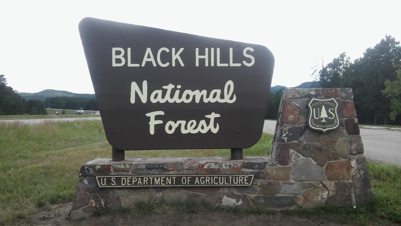
Returning to I-90 (by way of Belle Fourche) was a shock to my system. Welcome back to the billboards, the traffic, the ugly, boxy, light-flashing sprawl of humanity. To think I missed this just a day ago (well, more like I missed its conveniently-located gas stations, but I suppose you can't have one without the other). I circled southeast around the Black Hills, passing through Sturgis--at the time it was hosting its massive annual motorcycle rally, which explained all the bikers I’d been seeing everywhere--and exited at Rapid City, which was indeed citylike in size. The build-up stretched down US-16 all the way to the entrance of the Black Hills National Forest:
It briefly died down there, only to resume with a vengeance in Keystone, a Smokies-esque valley-town packed with hotels, souvenir shops, and tourist traps (why, for the love of Pamola, is there always a "Santa Land"?). I zipped out of there as fast as I could, but the tourists followed me up SD-244, filling that twisty, hilly, shoulderless two-laner with way more traffic than it was designed for. And then, at the apex of the twists, we came to the quintessential tourist trap, the magnum opus of a white supremacist whose greatest aspiration in life was to deface the mountains of his country with Ozymandian sculptures proclaiming its transient glory, whose current custodians demand an eye-popping $11 per vehicle for admission to the only parking lot with a full-on view: Mt. Rushmore. There was, of course, no way in hell I'd pay that much to look at a rock, so I stole a quick glimpse as I passed the entrance and drove on by. It's smaller than it looks in pictures, higher up and farther from the road than they show.
Further down the road, there was a pull-out from which one could see Washington's profile through a gap in the hills. They'll give you that much for free, eh? I climbed a nearby boulder, took a pic, and continued on.
 |
| You know how chocolate bunnies are so smooth that they're hard to get your teeth into? The Lars feel the same about sculptures. |
 |
| To be fair, the place was otherwise pretty nice. |

and down to the eponymous lake:

From the shore I spotted some granite outcroppings to the southwest. Was one of them the high point? I wondered, not yet knowing just how many chunks of granite stuck out of these hills.
 |
| They weren't, of course--it's much higher and further to the southwest. |
-
Though the Black Hills themselves are a relatively recent geological feature, having been uplifted just a few dozen million years ago, the rock at their core is ancient, four times as old as the venerable Appalachians. Those tantalizing granite spires I saw were formed 1.8 billion years ago in the Precambrian eon, around the same time as the appearance of the first eukaryotic organisms (the ones who first thought to pack their DNA into a nucleus--our very distant ancestors). Deep underground they endured the making and breaking of continents until at last, in the Tertiary period, they were thrust up from the Great Plains and into the elements, where the sediments enclosing them eroded away. These intrusions--the highest of which was until quite recently known as Harney Peak--dot the skyline of the southern Black Hills.
 |
| Yo. |
...the shapes of all things in the spirit, and the shape of all shapes as they must live together like one being. And I saw that the sacred hoop of my people was one of many hoops that made one circle, wide as daylight and as starlight, and in the center grew one mighty flowering tree to shelter all the children of one mother and one father. And I saw that it was holy.
Unfortunately for Black Elk's people, not long after his
vision took place gold was discovered in the Black Hills. Thousands of
prospectors rushed to the region, setting off the Black Hills War between the
U.S. and the Sioux and their allies. After the latter's defeat, the government
took control of the Hills (violating an earlier treaty that had guaranteed the
land to the Sioux in perpetuity) and evicted the Sioux onto several smaller
parcels of land; that same year the Hills became part of the newly-minted state
of South Dakota. The gold mines ran dry in the late 20th century, and,
following the typical pattern of photogenic regions that run out of natural
resources to exploit, the local economy shifted to tourism--and thus the
Smokieness.
-
I took my time getting up the next morning and wound up at the trailhead around 7:50:

My plan, which I developed on the spot with a brochure from that box, was to hike up the Willow Creek Trail (#5--all the trails here are numbered) to its intersection with the Harney Peak Trail (#9) a mile and a half out, then on for another ~3.5 miles to the summit. At the time I didn't recall why I'd chosen to start at this particular trailhead. I usually go with the shortest, most popular, and/or most straightfoward route to the summit, so I assumed it held at least one of those distinctions, but it turned out to have none of them. I didn't meet a single soul on my way up, which led me to assume I was the first one to start up the mountain that day--unexpected, given my late start, but it's happened before--until I hit the spur trail to the summit, which was packed. I asked some folks how they'd got there, and they said they'd approached from the south on a loop trail that passes through the observation tower. Why hadn't I chosen that trail, I wondered? I'm not such an isolation snob as to tack on an extra 2-3 miles round-trip and 1000 feet of gain just to avoid crowds. My choice remained a mystery until I (re-)discovered the answer while fact-checking for this post: that other trail starts in a state park with a $15 parking-lot fee.

But anyway, the trail I took, which began at the Willow Creek Horse Camp, was, as you'd expect, a horse trail. On one hand, that meant the terrain was no harder than the Blue Ridge trails back home, with gentle inclines and no major rocky sections (it's awfully hard to climb Class 3 without opposable thumbs), but on the other, I found myself dodging horse plops all the way up. There were also several waist-high fallen trees I had to scramble over (and occasionally under)--not a problem for a horse, I suppose, but tricky for us humans.
The Willow Creek trail meandered through the meadows for a while:

then met up with the trail to Harney:

which made a beeline for a massive granite fin that left the Lars drooling:
 |
| Be still, my rock-grinding stomach. |
 |
| How you doin'? |
The trail, like most of the Black Hills region, was very dry, with only one tiny creek crossing the whole way through--a welcome change from my snowmelt-sodden Northeastern hikes. The vegetation stayed mostly the same as I ascended: grasses and wildflowers, the occasional berry bush:
 |
| Edible? I dunno. You feelin' lucky? |
After climbing for a while, the ridge flattened out at a clearing:
 |
| from which I first glimpsed the summit tower. |

where, as mentioned, I encountered my first fellow hikers of the day. I took a much-needed rest, then followed them up the rocky path:

quivering with anticipation for the climb that surely awaited. How else would we summit the highest outcropping in the Black Hills? It's not like they'd slap stairs on it, would they?

In fact, that's exactly what they did. And not even uncomfortably steep and narrow stairs--these things were so low and wide they were practically wheelchair-accessible. We climbed up into that cavern, then circled around, climbed another flight of metal stairs, and took a grate-bridge over the path and onto the edge of the fin.
The tower on top was big, blocky, and honestly kind of ugly. It covered the entire natural high point, so that I couldn't tell where exactly it was:
 |
| That plaque clearly ain't it. |

then climbed up the tower (they'd saved the uncomfortably-steep stairs for inside) and enjoyed a panoramic view of the Black Hills:

though not Mt. Rushmore (there went my plan to bilk the National Park Service). All the while, several groups of hikers passed through the tower. The more adventurous ones scrambled over to check out the far pinnacles:

while the rest simply descended the tower's interior stairs and continued on that loop-trail I mentioned earlier. I went down there to check it out, then climbed back up from a little reservoir:
 |
| From which the old pump house pumped its water, presumably? |

that took me right back to the trail below. So there was a "natural" ascent route! I climbed back up it, retrieved my pack, and headed down.
The trail was just as deserted on my way down as it had been on my way up. I only passed two other parties--and bear in mind, this was on a summer Sunday: a pair of equestrians a mile out from the summit, and a large family group near the trailhead (who probably weren't going all the way up, judging by the number of small children in the group. It brought back memories of the one-mile nature-hike days of my childhood. "Can we go to the top of the mountain this time?" I'd beg my parents. "Please please pleeeeease?" "No, little Stoat," they'd reply with a sigh, "we have to get back to the hotel in time for Joey's nap." In their defense, I might have asked this on Mt. Rainier... but, at any rate, my sympathies went out to the bored-looking preteens in the group.) Whereas my morning ascent had taken me through the shade of the outcroppings, the afternoon found the trail in full sun:
 |
| Thanks for nothing. |
 |
| Estimated grasshopper population: 20,000. |
 |
| And even higher hills awaited... |
And so I drove over and out of Black Hills into extreme-western South Dakota, which transitioned invisibly into eastern Wyoming.
-
Though I didn’t learn so until my trip was over, I climbed Black Elk Peak just three days after its name was officially changed from Harney Peak. Thus, I'd thought of it as Harney the whole time I was there (as all but the title of this blog post represents). I'm definitely on board with the change, though. Unlike certain other figures who never even saw their namesake mountains (*cough cough* McKinley), General William S. Harney was at least relevant to the peak (he’d been the commander of the US military in the Black Hills for a number of years), but in my opinion Black Elk and his vision make for a much more interesting name-story.
<--prev | next-->
No comments:
Post a Comment