Friday, July 29, 2016

From Here On Out

Once again I've managed to finish a batch of posts just in time to set off to gather data for the next ones. This third leg of my trip will be the longest yet--and the last of the year--so listen up:


I'll head out from Ohio (following a family vacation) on August 7th in order to hit Illinois on a permissible day, then continue north through the Upper Midwest, down to Iowa, and back up to the Dakotas. From there I'll make a line down the Plains states, interrupted by quick jogs west to Mt.s Elbert and Wheeler, then rebound up from Texas by way of Arizona, Utah, and Idaho, and conclude with a visit to the former Mt. Mazama.

As I predicted back in April, the glaciated high points of Wyoming, Montana, Oregon, and Washington remain out of reach for me, as does a 22-mile day hike up Mt. Whitney (and its neighbor Boundary Peak is so close that I might as well do those two together). So it looks like I'll have to cap it at 42 high points for this summer... unless someone wants to step forward with airfare to Hawaii? (Any sarcastic fool who steps forward with airfare to Alaska is coming along to be my rope-buddy on Denali's glaciers. I mostly know how to self-arrest.)

So, here goes!
<--prev | next -->

Thursday, July 28, 2016

Highpoint #26: Jerimoth Hill, RI (811')

After a brief night in a disgusting motel in Clifton, MA (the cheapest I could find at the last minute), I headed down I-395 to snag my last high point. The highway was lined with bright broadleafed trees--I'd left the north woods behind in Maine--and traffic was light for a Saturday morning. I drove for several minutes through extreme-eastern Connecticut, then exited onto SR-101 and made a beeline for the border.

Jerimoth Hill was just a few minutes past it, atop a rise in the road:


Trees sealed off most of the view, but a glance down the road-cut revealed the distant hills of Connecticut:

On par with the view from Campbell Hill, I'd say.
A path beside the sign led into the piney woods atop the Hill:

Quite tame, compared to yesterday's hike.
I grabbed my camera and the Lars and walked right in.

Ten years ago I could have been shot for doing that.

Wednesday, July 27, 2016

Highpoint #25: Katahdin, ME (5267')

Two thousand feet is a long way to fall.

An obvious statement, but one whose reality is never quite felt until one finds oneself that far above the nearest level ground, inching along a jagged knife-edge so narrow that you don't dare stand or even step from rock to rock, but scuttle through on your butt like a hyperventilating crab with its shell soaked in rank nervous sweat and its claws clamped to holds it would never have trusted below--but it's that or thin air on the ridge of Katahdin--and a look up confirms, by Pamola! you've still got a mile to go to the summit.


Oh, Katahdin, wildest of the Northeastern high points. SummitPosters call your rugged profile "the only Western peak in the East." Your renown stretches south to Georgia, where each spring hundreds of saps slip on their hiking boots and go a-questing for your summit 2190 miles north. Far better writers than I have cowered before you--but if I am allowed a few brief words, let me simply say thank you, thank you, thank you for not killing me.

Thursday, July 21, 2016

Highpoint #24: Mt. Washington Redux (6288')

…and, to my surprise, it was.

 I returned to Pinkham's Notch shortly after 8 AM the next morning. The skies above the Presidentials were much clearer than they'd been the day before, so clear that I could see almost all the way up Washington from the road. Once there, there was no need to repeat the past day's deliberations; I packed my bag, strapped on my gaiters, and headed up the trail towards Tuckerman's Ravine. Following the recommendations of a map I'd found in the hostel, I planned to ascend via the headwall of the ravine, then descend the same Lion's Head route I'd taken last February.


That first wide stretch through the woods (the "trunk line," so to speak, from which all the summit trails branched off), was much steeper and rougher than I'd remembered. Or perhaps it was just easier to crunch my way up a smooth ice path than to stumble over the uneven rocks exposed by melting:


Either way, that bit was just a stroll in the forest compared to what came next.

Tuesday, July 19, 2016

Highpoint #24: Mt. Wa- JUST KIDDING!

For all their seeming interchangeability, those two tiny states who take up opposite corners of New England's interior, Vermont and New Hampshire, are quite different. And, in the arbitrary-conclusion-jumping spirit of the early novelists--arguably the first social scientists--I attribute this difference to their disparate geography. On one side of the state line, we have rolling farmland, socialist congressmen, and gentle Green Mountains; the other features dark fir forests, license plates emblazoned with "Live Free or Die," and the perilous Whites. I saw this shift in action as I crossed the border that afternoon on I-93. The pastoral meanderings of the Vermont state route from which I'd come gave way to a wide, fast, and empty highway. I zipped past steep hills covered in clinging firs, glancing up every so often towards the cloud-swathed peaks that filled the eastern horizon. Somewhere in that hazy mess was ol' Mt. Washington, the windswept mountain of my nightmares... and here I was, coming back for Round Two.

A raindrop hit my windshield as I entered White Mountain National Forest on US-302, and then another, and then all ten thousand of their closest friends crashed like a waterfall onto my car, as if to welcome me back to the Whites' crazy weather. In the midst of this cloudburst, I passed through Crawford's Notch:

The same place we ice-climbed last February.
and I must say, the hills were just as freakishly stark and intimidating in green as they were in white. I would have wandered up the train tracks in search of the spot where we climbed, but 1. it was raining, 2. they actually run the railroad this time of year, so it probably wasn't a good idea to walk on it, and 3. I had a check-in time to make.

Saturday, July 16, 2016

Highpoint #23: Mt. Mansfield, VT (4395')

Although I slept for over ten hours that night, I was still tired the next morning. Fifteen-mile hikes do that to you, I suppose. As I stretched my aching legs, I wondered if hiking the four highest Northeastern high points back-to-back-to-back-to-back was really the best idea. What's more, the weather up on Mt. Mansfield was slated to be just as grim--though less windy--as Marcy was yesterday. Perhaps I ought to have taken a rest day... but this motel was already breaking my budget, and my reservation at Katahdin wouldn't budge.

And so I decided to drive to Mansfield, at least, and see how the weather looked (and how my legs felt) when I got there. The trail up Mt. Mansfield was less than half the length of Marcy’s (only 6.6 miles round-trip), so I figured I could manage it even in slightly-suboptimal conditions. If all was good, I'd climb; if not, I'd camp nearby and wait it out.

After a lovely 45-minute drive through the Vermont countryside, I arrived at the logically named Underhill State Park and paid the $4 day-use fee. As I assembled my gear in the parking lot, a pack of  local college kids drove in and (noisily) started up the trail. I waited a moment, so as not to start right on their tail, then headed up myself.

My journey to Mansfield's summit, the highest of both Vermont and the Green Mountain chain to which it belongs, began on the Eagles Cut trail.


Friday, July 15, 2016

Side Trip: PANIC! on Lake Champlain, NY/VT (100')

The only problem with my pizza-plan, you see, was that there was no civilization within fifty miles of the Adirondack High Peaks.

Though I pulled over in each tiny hamlet I encountered on my way out of the park, none of them had a reliable phone signal, let alone 4G for maps. I had no idea where I was going at this point--all I knew was that Mt. Mansfield, my next high point, was east of here, and that the bridgeless expanse of Lake Champlain lay in between--so getting that data signal was my first priority. But there was none to be had all the way to the interstate. I got on I-87 southbound, thinking I could just head back to town where I'd lunched on the way up. After a few miles I pulled into a "text stop" to confirm my hunch.


Just your typical rest stop... except with French truckers.
While I fired off the usual "Hi Mom, I'm still alive" texts, several emails popped into my inbox. I flipped over to see what they were: spam, spam, newsletter, spam, and holy cow my Gmail account had been hacked. Google had blocked the illicit access, they informed me, but whoever it was had still cracked my password, so I had to-

The data signal blinked out of existence.

Tuesday, July 12, 2016

Highpoint #22: Mt. Marcy, NY (5343')

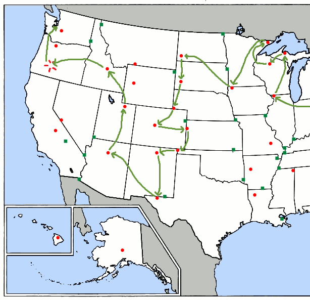
I spent the next morning resting and looking up directions to the Adirondacks. After some deliberation, I decided to circumvent Albany and take the long way around to I-87, since I'd set aside the whole day for getting there. So I set out from my motel around noon, under intermittent rain, and headed north. I clipped the corner of Vermont, passed through the lovely towns of Waloomsac and Schaghticoke (I pity the kindergartners who grow up learning to write those names). and finally hit the interstate near Malta. An hour's drive later, just after Queensbury, the road entered Adirondack State Park and all the usual highway services disappeared--including cell.

Like Maine's similarly vast and remote Baxter Park, Adirondack State Park is practically a state unto itself. It encompasses the entire Adirondack range, including six million acres--an area the size of New Hampshire--of mountains, valleys, rivers, lakes, lodges, camps, small towns, ski resorts, and sawmills. Yes, I said sawmills. This weird park is a patchwork of public and private land, the latter being  home to over 100 towns (though none large enough to get a proper phone signal) and 130,000 year-round residents.

The Adirondacks themselves are an anomaly among the Eastern mountains. They’re not Appalachian, for one—they were raised up from the Canadian Shield in a separate, ongoing orogeny. Unlike their neighbors to the east, they’re still growing, so when aliens arrive in a million years to sift through the remains of our civilization, they might well wonder why this blog was so concerned with little old eroded Mt. Washington rather than the cloud-splitting Adirondack High Peaks that loom over it.

Tahawus, or Cloud-Splitter, is already the Native American name for Mt. Marcy, and a far superior name in my opinion. Mt. Marcy sounds like a friendly little hill you’d take the kids up for a picnic (“Come on, Billy, smile! We’re going to Mt. Marcy!”); the deep, savage vowels of Tahawus are much more fitting for the wind-battered behemoth I climbed. The high point of New York, Mt. Marcy is also home to the state’s only region of alpine tundra—and the weather to match it.

Thursday, July 7, 2016

Highpoint #21: Mt. Greylock, MA (3489')

Western Massachusetts was an interesting place, a prelude to the northeastern countryside I'd spend the rest of this leg driving through. At first glance, it was much the same as any other mountain-land I'd seen, but subtle differences revealed themselves as I drove.

New England was full of old, small towns whose boundaries seemed almost to overlap: each time I left a town the next one was just a few feet down the road. (I didn't discover until I got home that in Massachusetts and Connecticut, "town" refers to a subdivision of a county, not necessarily an urban area.) What development there was was sparse yet evenly spread through the land. The countryside was rural, but on an entirely different scale from the vast, machine-shaped fields of the South and Midwest. The (literal) towns were made of small, old buildings joined by narrow streets. I could tell most of it hadn't been built with this century in mind. There was less fast food and fewer chain stores than I'd seen elsewhere in the country--though a lot more hipsters--and the few churches I saw all seemed to be historic.

I'd planned to camp on Mt. Greylock that night, so I picked up dinner in Pittsfield, then rushed on to the mountain's visitor center. I would have stopped to eat, but I didn't want to arrive too late to get a site. My instincts were right in that regard, but not enough, as it turned out...

Tuesday, July 5, 2016

Highpoint #20: Mt. Frissell, CT (2379')

I crossed the Hudson River on I-84 around noon, then turned north onto Taconic State Parkway. From the name, I’d expected an arrow-straight toll road, but it turned out to be the love child of the Blue Ridge and Fairfax County Parkways, with Mommy’s meandering curves through scenic hills and Daddy’s kamikaze speed demons taking said curves at 20 mph over the limit. Despite the wackos, I rather enjoyed the drive… so much that I missed my turn (though I swear it wasn’t labeled) and drove several miles farther north than intended. But there's no lack of roads through Massachusetts--even the rural bits--so I soon regained my course.

The correct road wound through a narrow gap in the Taconic Mountains, then slid down a shady rural valley. Much of it belonged to the Mt. Washington National Forest (named for the Massachusetts peak of that name, not the New Hampshire one). Eventually the road turned to gravel, just like in the national forests back home, then arrived after a few miles at the Mt. Frissell trailhead. I parked at the little pull-in, got my stuff together, and set off down the nearest trail.

A hundred feet in I stopped to glance at a map posted beside the trail by the Appalachian Mountain Club, the folks who maintain the AT and other nearby trails in the Northeast. Good thing I did, because I was headed in the wrong direction. That trail led east to Bear Mountain, Mt. Frissell’s next-door neighbor and the highest summit in Connecticut (though not the highest point--more on that later). I reversed course, crossed the road (and the state line), and headed up the correct trail.

Monday, July 4, 2016

Happy 4th of July!


I hope your holiday weekend's been as fun as mine. Posts will resume tomorrow!